Pomeroy
Description
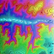
Using data from the USGS national map database, elevation measurements around Pomeroy, Washington are divided into 64 levels. Each level is given colors based on a hue sort. The levels are then filled from left to right using a luminance sort.
Author
danpederson
6 entries
Stats
Date
February 9, 2018
Colors
16,777,216
Pixels
16,777,216
Dimensions
4,096
×
4,096
Bytes
42,901,745